Duration:
(9 kilometers)
4 to 5 hours
Difficulty: 10/10. Hands required to climb some of the sections, even the bypasses. Option to make it easier is to stop at the infinity pool and return.
Cel phone coverage: None in the stream. Some when within 1 km of Tai-O
Water needs: 1.5 liters
Appreciation: 9/10. You can swim in all the pools but for the reservoir one (infinity pool)
Transportation: Take bus 11 from Tung Chung to Tai O, and back.Tends to get busy on weekends and holidays. You can also ferry to Mui Wo, take bus #1 to Tai-O, return via 11 to Tung Chung.
Why it's worth it:
---------------------------------------
 |
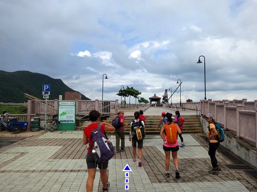
| Just off the bus terminus, take the bridge |
 |
| Pretty trivial at this point. Head right at the end of the bridge. |
 |
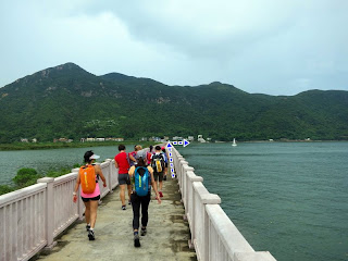
| It's about a 3km mostly flat walk until you will reach the stream entrance. |
 |
| The stream entrance, just after this little bridge |
 |
| View on the right from the stream entrance |
 |
First falls is just about 50m in. Bypass is on the right.
However, you can also swim to the bottom of the falls and climb it directly. Quite easy |
 |
| These falls can be bypassed on the left. From that point on, you can follow the yellow ribbons for the bypasses. Most of the time, you can also relatively easily climb in the waterfall itself. Then you'll reach the escarpment with the catch water basin (the so-called infinity pool). It should be bypassed on the left 'cause it is guarded now. |
 |
| Right after that bypass, and about 1km into the stream, you'll reach the Man Cheung Po infinity pool (a catchwater bassin really). Nice to chill there for a while but can no longer swim. You can exit to the trail here or keep going up the stream. |
 |
Then, right behind the infinity pool is a very tall waterfall which can be bypassed on the right.
That bypass is non-trivial. It is marked with yellow ribbons
|
 |
| Next waterfall is easy to recognized as it has a double stream. Bypass on the right |
 |
Right after, you reach a critical point in the trek where you don't want to go wrong. The streams forks into 2 branches. You absolutely want to be on the left branch. The right branch is more obvious but there's really nothing there all that interesting anymore and the exit is not obvious and involves bushwhacking.
So, stick to the left. There should be a ribbon marking the entry to the path to the left. Then you immediately climb the rocks that are in between the 2 streams.
|
 |
| Rocks to climb between the 2 streams. Very easy. No ribbons before you reach the top. |
 |
| You will see these nice falls on your left (if they are not all dried up), you know you are on the right path. |
 |
| Then the path on top of the ridge should be visible |
 |
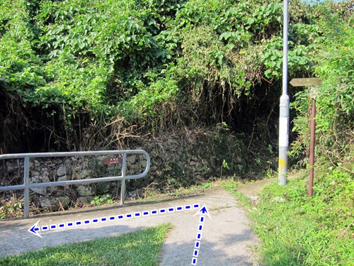
Finally, you'll reach out the paved path right by a bridge that crosses the stream which was on your left.
Head left over the bridge
|
 |
| Right. 'TAI O via LUNG TSAI' |
 |
| Left here at the intersection. From this point on, you can follow the yellow signs with 'TAI O via LUNG TSAI' |
 |
Lung Tsai Ng Yuen (龍仔悟園). The estate has been sold so, can't get in anymore.
For pictures and a bit of history: https://peterlamphotography.com/2015/01/25/ng-yuen-the-secret-garden/ |
 |
| There you go. From that point on, it is just a matter of following the path back to Tai-O where you can return home either via Bus 11 to Tung Chung, or bus 1 to Mui Wo, then ferry back to the city |